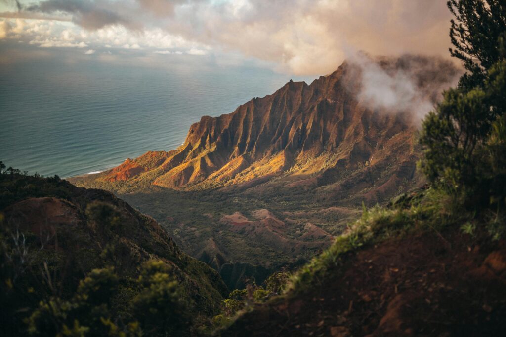
• All
  • BAKERSFIELD
  • GENERAL
  • HOLLYWOOD
  • MALIBU
  • SHENANDOAH VALLEY & SKYLINE DRIVE
  • SPACEQUEST
  • Uncategorized
  • YOLO

Malibu Canyon Adventures: Your Ultimate Guide to Coastal Mountain Escapes

I. Answer the Call of the Malibu Canyons

Just beyond the sun-drenched glamour of Malibu’s famed coastline lies a world less traveled, a realm of surprising wildness where the rugged Santa Monica Mountains carve dramatic canyons down to the Pacific Sea.1 This is the domain of Malibu Canyon Adventures – an escape hatch from the urban sprawl of Los Angeles, offering a raw, natural beauty that stands in stark contrast to the polished allure of the coast. Here, chaparral-cloaked hillsides plunge into shaded riparian woodlands, volcanic crags tower over meandering creeks, and panoramic vistas stretch from inland valleys to the distant Channel Islands.

The Santa Monica Mountains National Recreation Area (SMMNRA), a vast protected landscape, forms the magnificent backdrop for these explorations.2 Within its embrace, a diverse tapestry of experiences awaits the adventurous spirit. Prepare for challenging hikes leading to windswept peaks offering 360-degree views 4, serene walks along shaded creeks culminating in encounters with historic ruins 5, and exhilarating scenic drives along serpentine roads that test both nerve and machine.7 Discover unique flora and fauna thriving in a rare Mediterranean ecosystem 3, and delve into the layered history of the land, from its ancient Chumash inhabitants to its eras of ranching and Hollywood filmmaking.11

This guide serves as your key to unlocking the secrets held within these canyons. It aims to provide not only the inspiration to explore but also the practical knowledge needed to plan unforgettable adventures. Prepare to discover the unique confluence of coastal access and mountain wilderness that defines the Malibu Canyons, a place where you can climb a mountain, feel the ocean spray, and perhaps even sip local wine, all within a single, extraordinary day.1

II. Mapping Malibu’s Majesty: The Canyons Unveiled

The adventure begins with understanding the terrain. The Malibu Canyons are nestled within the Santa Monica Mountains National Recreation Area (SMMNRA), a sprawling protected landscape stretching over 157,700 acres from the Hollywood Hills westward towards the Pacific Ocean in Ventura County.1 This unique range remarkably bisects the massive Los Angeles metropolitan area, offering an invaluable natural escape.14 “Malibu Canyons” isn’t a single entity but rather an umbrella term encompassing several distinct canyon systems that drain either towards the coast or into inland valleys, each possessing its own character and access points.

Main Canyon Profiles:

  • Malibu Creek Canyon: This canyon holds the principal watercourse of the Santa Monica Mountains, Malibu Creek, which has dramatically carved its way through ancient volcanic rock over millennia, creating spectacular gorges and scenic pools.16 Accessed primarily via Las Virgenes Road (which becomes Malibu Canyon Road south of Mulholland Highway), about four miles south of the US-101 freeway 16, it’s the heartland of Malibu Creek State Park.16 The canyon is renowned not only for its geological beauty and diverse recreational offerings but also for its rich Hollywood history, having served as a backdrop for countless films and television shows.16
  • Topanga Canyon: Forming the eastern boundary for many park areas, Topanga Canyon stretches inland from the coast, accessible via the winding Topanga Canyon Boulevard (State Route 27).22 It’s home to Topanga State Park, considered the world’s largest wildland within the boundaries of a major city.19 Beyond the park, the canyon is known for its distinct artistic community vibe, dotted with unique shops, galleries, and restaurants nestled amongst the sycamores.8
  • Kanan Dume Corridor: Kanan Dume Road (County Road N9) serves as a vital and scenic connector, linking the US-101 freeway in Agoura Hills south through the mountains to Pacific Coast Highway (PCH) near Point Dume.28 This major commuting route passes through portions of the SMMNRA and is notable for its three sets of tunnels bored through the mountainsides.28 It intersects with the famed Mulholland Highway 25 and provides access to trailheads for areas like Zuma Canyon 30 and the iconic Point Dume State Beach and Preserve.31
  • Las Flores Canyon: This canyon offers direct coastal access, with Las Flores Canyon Road meeting PCH near Duke’s restaurant and Las Flores Beach.32 While known among cyclists for its challenging climbs into the mountains 32, access can sometimes be restricted, particularly following storms or fires, as indicated by recent alerts.33
  • Other Notable Canyons: The network extends further, including Corral Canyon, accessible from PCH via the Sara Wan Trailhead 39 and popular for loop hikes and cycling 32; Tuna Canyon, a steep, one-way downhill road known for views but often subject to closures 32; Decker Canyon (SR-23), another scenic and challenging drive connecting PCH near Leo Carrillo State Park to the inland areas via Mulholland Highway 7; Latigo Canyon, winding scenically between PCH and the Kanan Dume area 7; Zuma and Trancas Canyons, offering NPS-managed trails accessible from the coast 9; and Encinal Canyon, favored for cycling and scenic drives.7

Navigating this landscape requires awareness that it’s not a single, unified entity. The canyons and the parks within them fall under a complex patchwork of jurisdictions, including the National Park Service (NPS) 2, California State Parks 2, the Mountains Recreation and Conservation Authority (MRCA) and Santa Monica Mountains Conservancy (SMMC) 14, and Los Angeles County.44 This multi-agency management, while preserving vast tracts of land, means that rules and regulations—particularly concerning crucial details like dog access, parking fees, and bicycle permissions—can vary significantly, sometimes even between adjacent trail segments.16 Facility standards and emergency response coordination might also differ. Therefore, adventurers must verify the specific rules and conditions for the particular park or trail they intend to visit before heading out.

III. Your Basecamp for Adventure: Premier Parks & Trailheads

The Santa Monica Mountains National Recreation Area (SMMNRA) acts as the grand umbrella, encompassing many—though not all—of the region’s natural treasures.1 Established in 1978, it represents a unique cooperative effort between federal, state, and local agencies to preserve this vital landscape.2 While general access to the SMMNRA lands managed directly by the NPS is typically free 1, specific state parks or facilities located within its boundaries often require entrance or parking fees.16 The area boasts an impressive network of over 500 miles of trails, offering endless possibilities for exploration.1

Spotlight on Major Parks:

  • Malibu Creek State Park (California State Park): Often called the “Crown Jewel of the Santa Monica Mountains” 48, this 8,200-acre park is a centerpiece of the region.19 Located at 1925 Las Virgenes Road in Calabasas, just four miles south of Highway 101 16, it offers a stunning cross-section of canyon environments. Visitors can explore 15 miles of streamside trails through oak and sycamore woodlands 16, marvel at volcanic rock gorges and scenic pools 16, hike to the iconic M*A*S*H television series set 16, cool off at the popular Rock Pool 6, or discover the serene Century Lake.6 The park is also a major destination for rock climbing 16, mountain biking 16, and camping, with facilities for families, groups, and RVs.16 A visitor center provides historical and natural context.16 Hourly and daily parking fees apply.16 Note that dogs face significant restrictions, allowed only in the campground, day-use picnic areas, parking lots, and paved roads, but not on dirt trails.16 Its history is rich, encompassing the Chumash village site of Talepop 17 and its past life as the 20th Century Fox movie ranch.16
  • Topanga State Park (California State Park): Spanning 11,000 acres, this is the largest state park located entirely within the Los Angeles city limits.19 Bounded by Pacific Palisades, Topanga Canyon, and Rustic Canyon 22, its main access point is Trippet Ranch, reached via Entrada Road off Topanga Canyon Boulevard.22 The park features 36 miles of trails traversing open grasslands and oak woodlands, offering spectacular ocean views.22 Highlights include the panoramic vistas from Eagle Rock 19, access to segments of the Backbone Trail 19, and the hike-in Musch Trail Camp.22 The park showcases diverse geology, including faults and fossils.22 Parking fees are typically required at State Parks.22 A crucial rule: dogs are not permitted on trails, fire roads, or in the backcountry.22 Visitors should also be aware of potential construction closures impacting parking or access.22
  • Solstice Canyon (National Park Service): A picturesque canyon located just inland from PCH, accessed via Corral Canyon Road.5 A short 0.25-mile drive up Corral Canyon Road leads to the park entrance.5 Solstice offers hiking options for various levels, from an easy stroll along the main Solstice Canyon Trail to the more strenuous climb up the Rising Sun Trail for ocean views.5 A popular destination is the perennial waterfall, reached after passing the intriguing ruins of the Keller House (a stone hunting cabin from the 1860s) and the Tropical Terrace (the remains of the Roberts Ranch house designed by famed architect Paul Revere Williams in 1952).5 The canyon protects coastal sage scrub and riparian habitats.5 As an NPS site, access is free.42 However, parking is extremely limited and fills very quickly, especially on weekends, making carpooling highly advisable.46 Dogs are welcome but must remain on a leash (six feet or less).44 The canyon also has a history as the site of the Roberts Ranch and even a space technology research facility.44
  • Circle X Ranch (National Park Service): Situated in the rugged upper canyons near the Ventura County line, below the dramatic Boney Mountain 47, this former Boy Scout camp is accessed via Yerba Buena Road off PCH.47 It serves as a primary gateway to Sandstone Peak, the highest point in the Santa Monica Mountains (3,111 feet).4 Popular trails starting here include the Mishe Mokwa Trail loop, which passes landmarks like Balanced Rock, Split Rock, and Inspiration Point, and offers access to Tri-Peaks and Echo Cliffs.4 The Grotto Trail is another option.62 Climbing is also a listed activity.47 Facilities include restrooms, water, picnic areas, and a group campground (reservations required via Recreation.gov).47 Access is free 42, though camping fees apply.62 Separate parking lots exist for the Sandstone Peak and Mishe Mokwa trailheads.47 Dogs are allowed on leash within Circle X Ranch proper 4, but crucially, they are prohibited on trails entering the adjacent Point Mugu State Park backcountry and the Boney Mountain State Wilderness.63 Be aware that cell service is highly unreliable here.47
  • Point Mugu State Park (California State Park): Marking the western terminus of the Santa Monica Mountains 2, this large park offers coastal access and rugged mountain terrain, including the Boney Mountain State Wilderness.59 Popular areas include Sycamore Canyon 30 and the Ray Miller Backbone Trailhead near PCH.40 It’s connected to the rest of the range via the Backbone Trail.22 As is standard for State Park backcountry, dogs are generally not permitted on trails here.63
  • Leo Carrillo State Park (California State Park): Located on the coast at the northwestern edge of Malibu, this park is famed for its beautiful beaches, tide pools, and large campground.2 It offers a mix of coastal and canyon environments. Notably, dogs on leash are permitted in the campground, day-use areas, and specifically on North Beach, making it a rare dog-friendly beach option in the area.64

Key Trailheads:

Beyond the main park entrances, numerous trailheads provide access to the extensive trail network:

  • Solstice Canyon Trailhead: Corral Canyon Rd, off PCH.5 Access to Solstice Canyon trails, ruins, waterfall. Limited free parking.
  • Mishe Mokwa / Sandstone Peak Trailheads: Yerba Buena Rd.4 Two distinct lots near Circle X Ranch, accessing the highest peak and popular loop trails. Limited free parking, fills fast.
  • Trippet Ranch Trailhead (Topanga SP): Entrada Rd, off Topanga Cyn Blvd.22 Main access for Topanga State Park trails like Eagle Rock, Musch Trail. Parking fee applies.
  • Malibu Creek SP Main Trailhead: Las Virgenes Rd.16 Access to MASH site, Rock Pool, Century Lake, climbing areas. Parking fee applies.
  • Corral Canyon Trailhead (Sara Wan): PCH at Corral Canyon Rd.39 Access to Corral Canyon Loop Trail. Likely free parking.
  • Zuma/Trancas Canyons Trailhead: Near Zuma Beach area.9 Provides access to trails in these western canyons. Check NPS for specifics.
  • Backbone Trail Access Points: Several key crossings offer parking:
  • Kanan Dume Rd: Paved lot where BBT crosses Kanan Dume Rd.66
  • Latigo Canyon Rd: Dirt lot where BBT crosses Latigo Cyn Rd.66
  • Tapia Park: Near Malibu Creek SP on Malibu Cyn Rd, access to BBT segment.67
  • Stunt Road: Access point for BBT segments towards Topanga or Saddle Peak.32

A significant factor influencing any Malibu Canyon adventure is trailhead parking. Multiple accounts emphasize the severe limitations at popular spots, especially Solstice Canyon 46, the Sandstone Peak area 4, and coastal access points like Point Dume.31 Parking lots often fill very early, particularly on weekends.4 This necessitates careful planning: consider weekday visits, arrive at dawn, carpool whenever possible 46, or choose less-frequented trailheads. It’s also essential to factor in parking fees, which are standard at State Park facilities 16 but generally not required at NPS trailheads like Solstice or Sandstone Peak 42, although donations are often welcome.

(Table 1: Quick Guide to Major Malibu Canyons Parks)

Park NameManaging AgencyMain Access Road(s)Key Features/TrailsTypical FeeDog Policy Summary
Malibu Creek State ParkCA State ParksLas Virgenes/Malibu Cyn RdMASH Site, Rock Pool, Century Lake, Climbing Walls, Camping, Visitor Center, 15 mi trailsParking Fee ($) \$Restricted: Allowed only in campground, picnic areas, parking lots, paved roads 16 \
\Topanga State Park \CA State Parks \Entrada Rd (off Topanga Cyn) \Eagle Rock, Backbone Trail Access, Musch Trail Camp (hike-in), 36 mi trails, Panoramic Views \Parking Fee ()
Solstice CanyonNational Park ServiceCorral Cyn Rd (off PCH)Keller/Roberts Ruins, Waterfall, Solstice Cyn Trail (Easy), Rising Sun Trail (Strenuous), Ocean ViewsFree AccessPermitted: Allowed on leash (≤ 6ft) throughout 44
Circle X RanchNational Park ServiceYerba Buena Rd (off PCH)Sandstone Peak, Mishe Mokwa Trail, Balanced/Split Rock, Grotto Trail, Group Camping, ClimbingFree AccessPermitted (Leashed): Allowed in Circle X, but not Point Mugu SP backcountry 47
Point Mugu State ParkCA State ParksPCH, Yerba Buena RdSycamore Canyon, Boney Mtn Wilderness, Coastal Access, Backbone Trail terminusParking Fee ($) \$Restricted: Generally **not allowed** on backcountry trails 63 \
\Leo Carrillo State Park \CA State Parks \PCH \Beaches, Tide Pools, Camping, North Beach (Dog-Friendly) \Parking Fee ()

IV. Crafting Your Canyon Experience: Top Activities

The Malibu Canyons offer a playground for diverse adventures, catering to leisurely explorers and hardcore enthusiasts alike. From tracing historic paths on foot to navigating challenging climbs on two wheels or sheer rock faces, there’s an activity to match every inclination.

Hiking for Everyone:

The extensive trail network, exceeding 500 miles within the SMMNRA alone 1, provides options ranging from gentle, shaded strolls suitable for families to demanding ascents that reward with breathtaking panoramas.5

  • Easy Walks:
  • Solstice Canyon Trail: A mostly flat, partially shaded ~2-mile round trip leads past the historic Keller House ruins to the perennial waterfall and the impressive remains of the Paul Williams-designed Roberts Ranch House.5 Ideal for families and history enthusiasts.
  • Malibu Creek SP – Crags Road/High Road Loop: An easy 1.5-mile loop on wide, flat terrain near the main parking lot, offering a gentle introduction to the park.18
  • Malibu Creek SP – Rock Pool & Century Lake Trails: These easy trails 16 lead to popular features – the Rock Pool swimming hole 6 and the dam at Century Lake.6 Often combined for a scenic 4.5-mile loop with ample shade.67
  • Moderate Treks:
  • MASH Site Hike (Malibu Creek SP): The iconic hike to the outdoor set of the M*A*S*H TV show is roughly a 5-mile round trip from the main parking lot.6 It’s mostly flat with one significant hill in the middle, gaining 200-400 feet.6 Large sections are unshaded and can be hot.52 Features include the famous signpost and vehicle remnants.48 A shorter, ~1-mile round trip access is possible from the Crags Road entrance, though parking there is limited.52
  • Solstice Canyon Loop (via Rising Sun Trail): This ~3.2-mile loop adds the strenuous Rising Sun Trail to the canyon floor walk, gaining around 700 feet.57 It rewards climbers with expansive ridge-top views, including glimpses of the Pacific Ocean.57
  • Escondido Falls Trail: A popular ~3.5 to 3.8-mile round trip hike 68 accessed from PCH.68 Rated easy to moderate 68, it follows a creek, often shaded, to the base of the impressive multi-tiered Escondido Falls, the highest in the Santa Monica Mountains.71 The waterfall is most spectacular in spring after rains.68
  • Corral Canyon Loop: Accessed from the Sara Wan Trailhead on PCH 39, this loop offers ocean views and is considered relatively easy, making it a good choice for visitors.40
  • Eagle Rock Loop (Topanga SP): Starting from Trippet Ranch, a hike of about 2 miles leads to Eagle Junction.22 The loop trail includes Eagle Rock, a prominent outcrop offering panoramic views of the park.22
  • Strenuous Climbs:
  • Mishe Mokwa Trail to Sandstone Peak Loop (Circle X Ranch): This classic Santa Monica Mountains hike is a ~6 to 7-mile loop with significant elevation gain (1600-1800 feet).4 It showcases incredible geological features like Balanced Rock, Split Rock, and Echo Cliffs, passes Inspiration Point and Tri-Peaks, and culminates at Sandstone Peak, the highest point in the range at 3,111 feet.4 The peak itself is volcanic rock, despite its name.4 The trail can be crowded 4, and hiking counter-clockwise is generally recommended for a more gradual ascent.4 Leashed dogs are permitted.4
  • Bulldog Loop Trail (Malibu Creek SP): A demanding ~15-mile loop with over 3,000 feet of elevation gain.67 This challenging route utilizes steep fire roads like Bulldog Road and Mesa Peak Motorway, offering expansive views and solitude, best suited for experienced hikers or mountain bikers.18
  • Saddle Peak via Backbone Trail: Reaching Saddle Peak (around 2,800 feet 19) involves a strenuous climb with over 2,000 feet of elevation gain, typically via segments of the Backbone Trail.67 A common route is a ~4.2-mile round trip from the Stunt Road area.30
  • The Backbone Trail (BBT): This legendary trail is the spine of the Santa Monica Mountains, stretching approximately 65-67 miles from Will Rogers State Historic Park in the east to Point Mugu State Park in the west.9 It connects numerous parks and canyons, offering opportunities for long-distance backpacking (with limited designated camping spots 9) or section hiking. Key access points within the Malibu Canyons include crossings at Kanan Dume Road 66, Latigo Canyon Road 66, Malibu Canyon Road (Tapia Park) 67, Stunt Road 30, and trailheads within Topanga SP 22 and Circle X Ranch.59

(Table 2: Popular Malibu Canyon Hikes)

Hike NamePark/AreaApprox. Distance (RT)Approx. Elev. GainDifficultyKey FeaturesDog Policy Notes
Solstice Canyon TrailSolstice Canyon (NPS)~2 miles~100 ftEasyRuins (Keller, Roberts), Waterfall, ShadeAllowed on Leash 46
Solstice Canyon LoopSolstice Canyon (NPS)~3.2 miles~700 ftModerateRuins, Waterfall, Ridge Views, Ocean ViewsAllowed on Leash 46
MASH Site HikeMalibu Creek SP (State)~5 miles (from main)~200-400 ftModerateMASH Set Remnants, Canyon Views, Creek CrossingsNot Allowed on Dirt Trails 16
Escondido Falls TrailEscondido Canyon (MRCA?)~3.8 miles~400 ftMod-EasyMulti-tiered Waterfall (seasonal), Shaded CanyonCheck specific trail rules (often allowed on leash)
Corral Canyon LoopCorral Canyon (MRCA)~2.5 miles~500 ftEasy-ModOcean Views, Coastal Sage ScrubCheck specific trail rules (often allowed on leash)
Eagle Rock LoopTopanga SP (State)~4-5 miles (from Trippet)~800 ftModerateEagle Rock Vista, Panoramic Park ViewsNot Allowed on Trails 22
Mishe Mokwa/Sandstone Peak LoopCircle X Ranch (NPS)~6-7 miles~1600-1800 ftStrenuousHighest Peak, Rock Formations, 360° Views, Ocean ViewsAllowed on Leash (in Circle X) 4
Saddle Peak (via BBT)SMMNRA~4.2 miles (from Stunt)~2000+ ftStrenuousPanoramic Ocean/Canyon ViewsAllowed on Leash (on BBT/NPS land)

Scenic Drives:

For those who prefer to experience the dramatic landscapes from the comfort of their car, the canyons offer some of Southern California’s most exhilarating drives.

  • Iconic Routes:
  • Pacific Coast Highway (PCH/SR-1): The essential coastal artery, offering constant ocean vistas.7 The stretch between Point Dume and Point Mugu Rock is particularly breathtaking, passing iconic beaches like El Matador.7 Be prepared for potential heavy traffic, especially on weekends.41
  • Mulholland Highway: A legendary road winding through the heart of the mountains.8 It connects various canyons, passes viewpoints, and leads to landmarks like the motorcycle hangout, the Rock Store.32
  • Kanan Dume Road (N9): A scenic and efficient connector between US-101 and PCH near Point Dume.28 Features tunnels and passes through SMMNRA lands.28 A favorite drive for many.8
  • Topanga Canyon Blvd (SR-27): Connects the San Fernando Valley (US-101) to PCH.23 Passes through the unique community of Topanga 7 and provides access to Topanga State Park.23 Note: This road can be subject to full closure during Red Flag fire warnings.45
  • Decker Canyon Road (SR-23): A thrilling drive known for its tight hairpin turns, connecting PCH near Leo Carrillo State Park with the Mulholland Highway area.7 Offers spectacular views.8 Also a challenging cycling climb.32
  • Latigo Canyon Road: Another winding, scenic route connecting PCH to the Kanan Dume Road area.7 Features stunning coastal viewpoints, particularly near a sharp U-turn about 1.5 miles from PCH.7 A tough cycling climb.32
  • Las Virgenes/Malibu Canyon Road: The primary route into Malibu Creek State Park from US-101.8 Offers beautiful views through the canyon itself.75
  • Encinal Canyon Road: Parallels Decker Canyon further east, connecting PCH near El Pescador State Beach to Mulholland Highway.7 Passes through Charmlee Wilderness Park.7 A scenic cycling option.32
  • Tuna Canyon Road: A notable one-way downhill route from Saddle Peak Road to PCH.32 Known for stunning views but frequently closed due to safety concerns or fire/storm damage.14 Not suitable for uphill travel.32
  • Viewpoints: Seek out designated overlooks such as the Top of Topanga Overlook for valley views 24, pull-offs along Latigo Canyon for coastal perspectives 7, and the dramatic Point Dume headland.31 Hiking trails lead to other exceptional viewpoints like Inspiration Point 60 and Eagle Rock.22

(Table 3: Scenic Drives Quick Reference)

Road NameConnection PointsKey CharacteristicsNotable Access/Landmarks
PCH (SR-1)Santa Monica to Ventura CountyCoastal Views, Beach AccessPoint Dume, El Matador, Zuma Beach, Malibu Pier, Point Mugu
Mulholland HighwayCahuenga Pass to Leo Carrillo SP areaWinding Mountain Road, Canyon ViewsRock Store, Connects Multiple Canyon Roads, Park Access
Kanan Dume Rd (N9)US-101 (Agoura Hills) to PCH (Point Dume)Scenic Connector, Tunnels, Mountain ViewsAccess to Point Dume/Zuma, Backbone Trail crossing
Topanga Cyn Blvd (SR-27)US-101 (Woodland Hills) to PCHCanyon Views, Community FeelTopanga Village, Topanga State Park Access, Mulholland Jct.
Decker Cyn Rd (SR-23)PCH (near Leo Carrillo) to MulhollandVery Winding, Hairpin Turns, Rugged Canyon ViewsConnects to Mulholland Hwy West
Latigo Canyon RdPCH (Central Malibu) to Kanan Dume areaWinding, Coastal Viewpoints, Canyon ViewsConnects to Kanan Dume Rd, Backbone Trail crossing
Malibu Cyn RdPCH (Malibu) to Mulholland HwyMain Canyon Thoroughfare, Volcanic Rock FormationsMalibu Creek State Park Access (via Las Virgenes Rd north)

Rock Climbing:

The volcanic rock formations of the canyons provide excellent opportunities for climbers.

  • Malibu Creek State Park: This is the premier climbing destination in the area.16 It offers over 100 bolted sport climbs, primarily on steep, pocketed volcanic rock, with grades ranging from beginner-friendly 5.5 up to challenging 5.14.50 Popular areas include the Planet of the Apes Wall (known for top-roping and some sport routes) 50, the Ghetto Wall (sport climbing) 50, the Century Lake Area (including Drifter Wall) 50, Stumbling Blocks (offering easier climbs, good for beginners or warm-ups) 50, and Mt. Gorgeous.50 Detailed guidebooks covering the area are available.77 Climbers should be mindful and courteous, as they share this popular park with hikers, swimmers, and others.50
  • Circle X Ranch / Echo Cliffs: Climbing is a recognized activity at Circle X Ranch 47, and the nearby Echo Cliffs are prominent geological features visible from trails like Mishe Mokwa 4, suggesting climbing potential in this western section of the mountains.
  • Point Dume: The dramatic cliffs at Point Dume State Beach also attract rock climbers.76
  • Safety and Ethics: It’s crucial to be aware of and follow any specific climbing regulations or closures issued by the managing park agency (NPS or State Parks).42 Always use proper safety gear (helmet, harness, etc.), climb within personal limits, check weather conditions (wet rock can be dangerous), and strictly adhere to Leave No Trace principles to protect the environment.51

Cycling Adventures:

The Santa Monica Mountains are a renowned destination for both road and mountain cyclists.

  • Road Cycling: The area is considered one of the best in the US for road cycling climbs, offering challenging ascents with rewarding scenery and favorable weather.32 Key climbs ascending from PCH include the notoriously steep Deer Creek Road (averaging over 11%, with sections much steeper), Las Flores Canyon, Corral Canyon, Decker Canyon, and Latigo Canyon – these five make up the challenging “5 Witches of Malibu” ride.32 Other significant climbs include Piuma Road, Stunt Road, Yerba Buena Road, and stretches of Mulholland Highway.32 Many of the scenic driving routes, like Kanan Dume Road 28 and Encinal Canyon Road 32, are also popular cycling routes. Note that Tuna Canyon Road is strictly one-way downhill and not suitable for climbing.32
  • Mountain Biking: Off-road cycling is permitted on designated trails, but rules vary. Malibu Creek State Park offers a range of options, from the easy, relatively flat Crags Road 18 suitable for beginners and families, to the very steep and challenging fire roads like Bulldog Road and Mesa Peak Motorway, preferred by experienced riders.18 Topanga State Park restricts mountain bikes strictly to fire roads.22 In Solstice Canyon, biking is generally permitted on the main Solstice Canyon Road (paved/dirt).44 Cyclists must always control their speed, yield the right-of-way to hikers and equestrians, check trail signage for restrictions, and minimize environmental impact.18

Bird Watching & Photography:

The diverse habitats support abundant wildlife and offer stunning scenery for observation and capture.

  • Birding Hotspots: The varied ecosystems, from coastal scrub and riparian corridors to oak woodlands and chaparral, attract a wide array of bird species.3 Excellent birding locations include Malibu Creek State Park, with its mix of habitats attracting hawks, woodpeckers, swallows, and riparian species 54; Topanga State Park, offering views of grassland and oak woodland birds 22; Franklin Canyon 79; and the Satwiwa Native American Indian Culture Center area.1 Commonly sighted birds include California Towhee, Spotted Towhee, Wrentit, California Scrub-Jay, Acorn Woodpecker, Nuttall’s Woodpecker, Red-tailed Hawk, Red-shouldered Hawk, Cooper’s Hawk, White-tailed Kite, California Quail, Anna’s Hummingbird, Allen’s Hummingbird, and Western Bluebird.54 Local Audubon Society chapters often lead guided walks.54
  • Photography Spots: The canyons are a photographer’s dream. Compelling subjects include the historic ruins in Solstice Canyon 5 and the MASH set in Malibu Creek 49; waterfalls, particularly Solstice Falls 5 and the impressive Escondido Falls 68; dramatic rock formations like those around Sandstone Peak 4, the gorges of Malibu Creek 16, the sea stacks at El Matador State Beach 64, and the cliffs of Point Dume 31; sweeping panoramic vistas from peaks like Sandstone 4, Eagle Rock 22, and Inspiration Point 60, or from numerous overlooks along the scenic drives 7; vibrant wildflower displays in spring 10; and the stunning coastline itself, captured from PCH or elevated viewpoints.7 Note that permits are required for commercial filming and photography within the parks.16

The interconnectedness of these activities is a defining feature of Malibu Canyon adventures. Scenic drives serve as conduits to trailheads, wineries, and unique restaurants.8 Hiking trails often lead directly to historical sites or geological wonders.4 The same winding roads challenge both drivers and cyclists.7 Birdwatching naturally pairs with hiking through diverse habitats.54 This synergy allows visitors to craft rich, multi-faceted itineraries, perhaps combining a morning hike with an afternoon wine tasting or a scenic drive culminating in a sunset dinner, making the most of the region’s diverse offerings.

V. Malibu’s Hidden Treasures: Beyond the Trails

While hiking, biking, and climbing form the core of adventure, the Malibu Canyons hold other gems waiting to be discovered, from world-class wineries and unique dining experiences to tangible links with history and breathtaking viewpoints.

Sip and Savor – Wineries:

The unique coastal mountain terroir has given rise to the Malibu Coast American Viticultural Area (AVA), home to numerous vineyards and tasting experiences, often nestled in scenic canyon settings.

  • Tasting Rooms & Vineyards:
  • Rosenthal – The Malibu Estate: Offers a convenient tasting room located just off PCH near the intersection with Topanga Canyon Boulevard.27 For a deeper dive, they also provide tours and premium tastings by appointment at their spectacular vineyard estate situated 1,400 feet up in the hills.85 They feature estate wines like Cabernet Sauvignon and Chardonnay, as well as their Surfrider label.85
  • Saddlerock Ranch / Malibu Family Wines: This sprawling ranch on Mulholland Highway serves as both a vineyard and a popular event location.84 It’s famously associated with Malibu Wine Hikes, which explore the property, including unique features like Chumash cave paintings.72 While their original public tasting room did not reopen after the 2018 Woolsey Fire 64, experiences like the hikes and potentially the associated Malibu Wines & Beer Garden (check current status) offer ways to sample their Saddlerock label wines.72
  • Cornell Winery & Tasting Room: Located in the historic hamlet of Cornell near Mulholland Highway, this spot offers an upscale wine country experience within a rustic, historic setting.72
  • Cielo Farms / The Barn at Cielo: This stunning, Tuscan-inspired estate on Mulholland Highway boasts panoramic mountain views.84 Visitors can reserve tables for wine tasting at “The Barn,” featuring estate varietals like Cabernet Sauvignon, Syrah, and Merlot.87 The picturesque venue also hosts weddings, private events, and filming.87
  • Calamigos Ranch: While primarily known as a luxury ranch resort and wedding venue 88, Calamigos is situated deep in Malibu wine country off Kanan Dume Road 8 and features beautiful vineyard settings for events.88 It’s also home to the popular outdoor dining spot, The Malibu Cafe.8
  • Strange Family Vineyards: Offers a tasting room conveniently located in the Malibu Country Mart area.65 They specialize in Pinot Noir, Chardonnay, and sparkling wines produced from their estate vineyards in the acclaimed Sta. Rita Hills AVA.65
  • Triunfo Canyon Vineyards: A smaller, 9-acre estate vineyard located high in the mountains along Triunfo Creek, focusing on hand-tended Cabernet Sauvignon and Meritage blends.89 Prospective visitors should verify public accessibility and tasting options.
  • Wine Tours & Experiences: Beyond traditional tastings, unique ways to explore the vineyards include guided hikes combined with wine (Malibu Wine Hikes 64), adventurous 4×4 vehicle tours through the vines 71, charming vintage VW bus tours connecting local wineries 72, and even guided electric mountain bike tours incorporating winery stops.71

Taste of the Canyons – Restaurants & Cafes:

The canyons and nearby coast offer dining experiences ranging from rustic hideaways to world-renowned establishments.

  • Unique Settings:
  • Saddle Peak Lodge: Tucked away near Calabasas and Topanga Canyon, this historic lodge provides a unique, rustically romantic atmosphere for fine dining, often featuring game meats alongside contemporary Californian cuisine.92 Their Sunday brunch is popular, and the upstairs Double Barrel Whiskey Room offers an exclusive experience.92
  • Old Place: Situated in the historic Cornell area near the intersection of Mulholland Highway and Kanan Road 8, this eatery is famed for its authentic, rustic charm and history, offering a step back in time.
  • Cafe on 27: Perched on the hillside in Topanga Canyon, this cafe offers breathtaking canyon views from its multi-level patio, creating a unique “treehouse” dining experience.24 Known for classic American breakfast and brunch fare.26
  • Malibu Farm Restaurant & Cafe: Occupying an iconic location at the end of the Malibu Pier, both the casual Cafe and the slightly more formal Restaurant offer stunning ocean views and pride themselves on fresh, local ingredients.24
  • Neptune’s Net: A legendary seafood shack and biker hangout located on PCH at the Ventura County line.61 Known for its casual atmosphere, fried seafood platters, and ocean-view picnic tables.93
  • Paradise Cove Beach Cafe: Offers beachfront dining with pier views in a casual setting.76 Famous for its large portions and classic California beach vibe. Note that reservations function as a priority waitlist, and waits can still occur.94
  • Geoffrey’s Restaurant: An upscale PCH establishment known for its romantic ambiance, featuring waterfalls, lush tropical plants, and magnificent coastline views.27 Specializes in international Californian cuisine, perfect for brunch or sunset dinners.94
  • Other Notable Mentions: For high-end Japanese cuisine and celebrity sightings, Nobu Malibu is iconic.24 Broad Street Oyster Company draws crowds for its exceptional lobster rolls and fresh oysters.71 Malibu Seafood Fresh Fish Market & Patio Cafe is a long-standing local favorite for fresh, simply prepared seafood enjoyed on its ocean-view patio.71 In Topanga, the Inn of the Seventh Ray offers upscale dining in a magical creekside setting 24, while the Reel Inn provides a casual fish market atmosphere.22 Near Point Dume, The Sunset Restaurant offers hidden beachfront dining.24 Other options include Zinqué (French-inspired, all-day cafe) 71, Gravina Malibu (cozy Italian) 94, Carbon Beach Club (at Malibu Beach Inn) 94, John’s Garden (healthy sandwiches/juices in Malibu Country Mart) 24, Country Kitchen (casual PCH spot for burritos) 74, and Duke’s Malibu (Hawaiian-themed, surf history, ocean views).34

Step Back in Time – Historical Sites:

The canyons are rich with tangible history, often discovered right alongside the trails.

  • MASH Set (Malibu Creek SP): The remnants of the outdoor filming location for the beloved TV series remain a popular pilgrimage site.48 Accessible via a moderate 5-mile round trip hike from the main parking lot 16, visitors can see the iconic signpost, a rusting jeep and ambulance (plus a newer replica ambulance), and interpretive panels showing where key structures like the Swamp and Mess Tent once stood.49 Much of the set was destroyed in a 1982 wildfire, an event written into the show’s finale.70
  • Paramount Ranch (NPS): This historic movie ranch in Agoura Hills has hosted filming since 1927.13 Its famous Western Town, seen in productions like Dr. Quinn, Medicine Woman 96, was tragically destroyed by the 2018 Woolsey Fire.13 However, reconstruction is underway (Phase 1: 2024-2025), with plans to build four new, fire-safe structures (barn, prop shed, pavilion, restrooms) in the historic footprints, enabling filming and events to resume.13 The train depot and the chapel (used in Westworld) survived the fire and can still be seen.96 Hiking trails through the ranch remain open during construction.96 This is the only NPS site specifically dedicated to American filmmaking history.13
  • Solstice Canyon Ruins: An easy hike up Solstice Canyon reveals layers of history.5 Visitors encounter the stone remains of the Keller House, a hunting cabin dating back to around 1865 (possibly Malibu’s oldest stone building), damaged in the 2007 Corral Fire.5 Further up, near the waterfall, lie the more extensive brick and stone ruins of the Roberts Ranch House, also known as “Tropical Terrace,” designed by pioneering African American architect Paul Revere Williams in 1952 and destroyed by fire in 1982.5
  • Satwiwa Native American Indian Culture Center (NPS): Located in the Rancho Sierra Vista area near Newbury Park, this center, operated in partnership with local tribes, offers insights into the cultures of the Chumash and Tongva peoples who have inhabited the region for millennia.1 It features cultural displays and a native plant garden.1
  • Adamson House (State Park): Situated near Malibu Pier and Lagoon, this stunning 1929 Spanish Colonial Revival home showcases exquisite Malibu Potteries tilework and offers a glimpse into the early days of Malibu’s development as a coastal enclave.71 Docent-led tours of the house interior are available on specific days (cash only), while the grounds and gardens are open daily.71
  • Trippet Ranch (Topanga SP): The main visitor hub for Topanga State Park was once a “gentleman’s ranch,” providing a weekend getaway from the city.23 Its buildings and grounds serve as a starting point for exploring the park’s trails.22

Experiencing history in the Malibu Canyons is often an active pursuit. Unlike static museum displays, the past is encountered outdoors – hiking to the MASH set or Solstice ruins, exploring the grounds of Paramount Ranch or Adamson House, or starting a trek from the historic Trippet Ranch. This tangible connection allows visitors to physically inhabit spaces shaped by Chumash life, Spanish ranchos, homesteaders, and Hollywood legends, blending adventure with discovery across multiple layers of time. The ongoing reconstruction at Paramount Ranch further underscores that this history is not just preserved but continues to evolve.13

Panoramic Vistas – Viewpoints:

Numerous spots offer stunning perspectives over the canyons, coastline, and ocean.

  • Point Dume: This prominent coastal bluff provides arguably the most iconic viewpoint, offering 360-degree vistas encompassing Santa Monica Bay, the Malibu coastline north and south, the inland mountains, and, on clear days, Catalina Island.31 Accessible via trails from Westward Beach or limited parking near the summit, it features a viewing platform and is a prime spot for whale watching during the migration season (December-April).31
  • Inspiration Point (Mishe Mokwa Trail): A short spur trail off the Sandstone Peak loop hike leads to this dramatic promontory.60 Marked by a Boy Scout memorial, it delivers truly inspirational views of the Pacific Ocean and surrounding peaks.60
  • Eagle Rock (Topanga SP): This large sandstone outcrop, reached via the Eagle Spring loop trail from Trippet Ranch, looms over the landscape and provides sweeping panoramic views of Topanga State Park.22
  • Sandstone Peak Summit: As the highest point in the Santa Monica Mountains (3,111 ft), the summit offers unparalleled 360-degree views across the range, out to the ocean and Channel Islands, and inland towards the valleys and distant San Gabriel Mountains.4 The W. Herbert Allen memorial plaque marks the top.4
  • Scenic Drive Overlooks: Keep an eye out for designated and informal pull-offs along the winding canyon roads. Notable spots include viewpoints on Latigo Canyon Road 7, Kanan Dume Road 66, Mulholland Highway (like the Georges Gap Trailhead area 75), and the Top of Topanga Overlook offering San Fernando Valley views.24

VI. The Living Landscape: Nature’s Wonders

The Malibu Canyons are defined by a unique and dynamic natural environment, shaped by powerful geological forces, adapted to a rare climate, and teeming with diverse plant and animal life.

Geology & Terrain:

  • Formation: The Santa Monica Mountains are part of California’s Transverse Ranges, unusual for their east-west orientation.17 They are relatively young mountains, uplifted from the sea less than 10 million years ago through complex processes of folding, faulting, and crustal rotation.17 The range is dramatically defined by major fault systems like the Malibu Coast and Santa Monica faults along its southern edge.100
  • Rock Types: The geology is a complex mosaic reflecting this tumultuous history. The oldest rocks are the Santa Monica Slate, dating back to the Jurassic period (around 200 million years ago).99 Intrusions of granitic rock, related to ancient volcanic activity, occur, notably in the eastern end near Griffith Park.99 Thick layers of reddish Sespe Formation sandstone and conglomerate, deposited by ancient rivers during the Oligocene epoch (20-40 million years ago), add color to the landscape.17 The middle Miocene epoch (around 15-18 million years ago) was particularly active, producing the widespread Topanga Group, which includes marine and nonmarine sandstones and shales (some fossil-rich), and the significant Conejo Volcanics – layers of basalt, andesite, and rhyolite lava flows, especially thick in the western part of the range.17 Overlying these are often layers of Monterey Formation shale and diatomite, formed from microscopic marine organisms.99 South of the Malibu Coast Fault, a different geological province exists, involving the Zuma Volcanics, Trancas Formation, and underlying Catalina Schist basement rock, fragments of which form the unique San Onofre Breccia found near the coast.99 Visitors can readily observe these geological features: the volcanic crags lining Malibu Creek 17, crumbly sandstone formations in Santa Ynez Canyon 22, and evidence of fault lines throughout Topanga State Park.22
  • Ecosystem: The Santa Monica Mountains boast a rare Mediterranean Climate – one of only five such zones worldwide.1 This climate, characterized by mild, wet winters and long, hot, dry summers, dictates the types of plants and animals that thrive here and supports exceptional biodiversity.3

Flora – Plant Communities:

The vegetation is beautifully adapted to the climate and terrain.

  • Dominant Types:
  • Chaparral: This is the quintessential plant community, covering vast slopes with dense thickets of drought-tolerant, evergreen shrubs. Key species include chamise, various species of ceanothus (wild lilac), manzanita, laurel sumac, toyon, and mountain mahogany.3 Chaparral plants have adaptations like small, leathery leaves to conserve water and are highly adapted to periodic wildfire.
  • Coastal Sage Scrub: Often found on drier, south-facing slopes or at lower elevations, this community consists of smaller, drought-deciduous or semi-woody shrubs, sometimes called “soft chaparral”.10 Characteristic plants include California sagebrush (whose pungent scent fills the air after rain), California buckwheat, black sage, and purple sage.3 This habitat is crucial for many rare plants and animals but has faced significant loss statewide.10
  • Other Communities:
  • Oak Woodland: Shadier slopes and canyons support woodlands dominated by majestic Coast Live Oaks and, in some areas, Valley Oaks.3
  • Riparian Woodland: Lush corridors of moisture-loving trees like Western Sycamore, willows, and cottonwoods flourish along creeks and streams.3
  • Grasslands: Open areas, particularly on clay soils, feature grasslands, though many native bunchgrasses like purple needlegrass have been replaced by non-native annual grasses and mustards.9
  • Coastal Habitats: Near the ocean, specialized communities like Coastal Salt Marsh (in lagoons) and Coastal Strand (on dunes) exist.3
  • Wildflowers: Spring transforms the canyons into a tapestry of color, typically from February through June, with blooms peaking after winter rains.10 Wildfires can also trigger spectacular, though temporary, displays of “fire follower” wildflowers in subsequent years.83 Common and beloved species include the vibrant orange California Poppy, various shades of Lupine, golden Sticky Monkeyflower, white puffs of California Buckwheat, purple Black Sage, papery California Everlasting, red Indian Paintbrush, delicate Elegant Clarkia, blue clusters of Blue Dicks, iris-like Blue-Eyed Grass, stunning Mariposa Lilies, purple Phacelia, green Wild Cucumber vines, pink Morning Glory, impressive stalks of Chaparral Yucca, and towering yellow Bush Mallow, which can form tunnels over trails after fires.10

Fauna – Wildlife:

The diverse habitats support a rich array of animal life, adapted to the Mediterranean climate and urban-adjacent environment.

  • Mammals: Mule deer are commonly seen browsing.54 Coyotes are adaptable residents 1, along with bobcats 1, gray foxes 47, rabbits, and various squirrels and rodents. The most elusive large mammal is the mountain lion (puma or cougar). A small, genetically isolated population inhabits the Santa Monica Mountains, facing significant threats from habitat fragmentation (roads like the 101 freeway act as major barriers), rodenticide poisoning (ingested from prey), and low genetic diversity.1 Researchers actively study this population to understand and mitigate these challenges. Along the coast, marine mammals like dolphins 1 and migrating gray whales (December-April) 31 can often be spotted from viewpoints like Point Dume.
  • Birds: The area is a birdwatcher’s paradise, with estimates suggesting around 500 species utilize the habitats.3 Common year-round residents and seasonal migrants abound (see Bird Watching section for examples).54 Raptors, including Red-tailed Hawks, Red-shouldered Hawks, Cooper’s Hawks, and White-tailed Kites, are frequently seen soaring overhead.79
  • Reptiles & Amphibians: Sunny trails are prime spots for observing lizards, such as the Western Fence Lizard (often called “blue-belly”) and the larger Southern Alligator Lizard.5 Various snakes also inhabit the area, including the venomous Southern Pacific Rattlesnake – hikers should always be aware of their surroundings and watch where they step and place their hands.44 Amphibians are more tied to moist areas. Notably, the California Red-Legged Frog, federally listed as threatened, had vanished from the Santa Monica Mountains by the mid-20th century but is now the subject of dedicated reintroduction efforts by the National Park Service, with breeding populations being re-established in carefully selected streams.103
  • Endangered/Threatened Species: Besides the California Red-Legged Frog 103, the Santa Monica Mountains Dudleya (a succulent plant) is listed as threatened.104 The fragile Mediterranean ecosystem supports numerous other sensitive plant and animal species, highlighting the importance of conservation efforts within the SMMNRA.102

The interplay between fire and water is fundamental to understanding the living landscape of the Malibu Canyons. The geology itself is partly volcanic 17, and the sedimentary layers tell stories of ancient seas and rivers.98 The dominant plant communities, chaparral and coastal sage scrub, are not just tolerant of fire but often dependent on it for regeneration 10, leading to bursts of wildflowers in burned areas.83 However, this fire adaptation creates significant risk, especially during dry, windy conditions.105 Following fires, the denuded slopes become highly vulnerable to erosion and dangerous mud and debris flows when winter rains arrive.38 This cycle has repeatedly impacted the landscape and human structures within it, destroying historic buildings like those in Solstice Canyon 56, the MASH set 70, and Paramount Ranch.13 Water, primarily from winter rains, carves the canyons 16, sustains the vital riparian woodlands 3, and dictates the timing of wildflower blooms and waterfall flows.68 Appreciating this powerful dynamic enhances the visitor’s understanding of the landscape’s beauty, its resilience, and the inherent natural hazards that demand respect and preparedness.

VII. Whispers of History: Stories from the Canyons

The Malibu Canyons resonate with echoes of the past, holding stories of the indigenous peoples who first thrived here, the ranchers who shaped the land, and the Hollywood dream-makers who used its landscapes as their canvas.

The First Peoples – Chumash:

Long before Spanish explorers arrived, the coastal mountains and canyons were home to the Chumash people, who inhabited this region for thousands of years.11

  • Territory & Settlements: The Chumash territory stretched along the coast from present-day San Luis Obispo south to Malibu, extending inland and encompassing the northern Channel Islands.11 The groups in the Malibu area are often referred to as Ventureño Chumash.11 They lived in permanent, named towns, often situated near reliable water sources and resource areas. Important village sites within the parklands include Humaliwo, located on a high point near Malibu Lagoon 11, and Talepop, discovered near the main parking area of Malibu Creek State Park.17 These villages featured dome-shaped dwellings made of tule reeds or brush, along with communal structures like sweat lodges, ceremonial enclosures, and cemeteries.11 Temporary camps were established seasonally for hunting or gathering specific resources.11
  • Culture & Society: The Chumash developed a complex and sophisticated society. They had a hierarchical social structure, often led by hereditary chiefs known as Wot, who managed resources and held significant influence.11 They were renowned artisans, excelling in basketry 108 and the production of shell beads, which served as a form of currency (“Chumash” itself is thought to mean “bead maker” or “seashell people”).11 They engaged in extensive trade networks, exchanging goods between coastal, island, and inland groups.11 Their technological prowess is exemplified by the tomol, a sturdy plank canoe sewn together and sealed with asphaltum, enabling sophisticated deep-sea fishing and travel to the Channel Islands.108 The Chumash also left behind a legacy of intricate rock art, often associated with shamanistic practices and celestial observations.11
  • Subsistence: As skilled hunter-gatherers, the Chumash expertly utilized the rich and diverse resources of their environment. Marine resources were crucial, including a wide variety of fish, shellfish (mussels, clams, abalone), and sea mammals.109 Inland, they harvested acorns (a dietary staple requiring extensive processing), seeds like chia, and hunted deer and other game.17 They quarried materials like soapstone (steatite), often obtained through trade with island groups, for making bowls, pipes, and ornaments.108
  • Legacy: While the arrival of the Spanish missions in the late 18th century led to devastating changes, including disease, displacement, and cultural disruption 110, the Chumash people endure. Their deep history is preserved in archaeological sites, living traditions, and cultural centers like Satwiwa.1 Visitors can connect with this heritage through interpretive displays, preserved rock art (though most significant sites are sensitive and not publicly advertised, some cave paintings are noted at Saddlerock Ranch 72), and by appreciating the landscape that sustained their culture for millennia.

The Ranching Era:

Following the decline of the Spanish missions and the secularization of their lands in the 1830s, vast tracts of California, including the Santa Monica Mountains, were granted as private ranchos, primarily for raising cattle and sheep.111

  • Land Grants & Rancheros: Huge grants like Rancho Las Virgenes (covering areas around modern Agoura Hills and Westlake Village) 12, Rancho El Conejo (to the west) 12, and Rancho Guadalasca (further west) 12 defined the landscape. The rancheros, often descendants of Spanish soldiers or early settlers, introduced European livestock, crops like wheat, and a distinct Californio culture centered around horsemanship and large fiestas.111 Water was always a critical, and often scarce, resource.110
  • Transition & Agriculture: Over time, particularly after California became part of the United States, these vast ranchos were gradually broken up and sold.110 Figures like the Frenchman Pierre Agoure (adopting the title “Don Pedro”) acquired significant acreage in the late 19th century.110 Improved water pumping technology allowed for an increase in agriculture, with orchards, vegetable fields, and wheat farms supplementing the traditional cattle and sheep ranching.110 Early subdivisions like “Independence Acres” emerged in the 1920s, though water scarcity remained a challenge.110
  • 20th Century Ranches: Ranching continued into the 20th century, with notable properties like Rancho Sierra Vista. Purchased by geologist Carl Beal in 1936, he developed extensive water systems (wells, dams, pipelines still visible today) and roads.12 Later owned by International Harvester heir Richard Danielson, significant portions of this ranch were eventually donated or sold to become Point Mugu State Park and part of the SMMNRA, including the area now housing the Satwiwa Center.12 Trippet Ranch, now the main entrance to Topanga State Park, served as a “gentleman’s ranch” for weekend escapes.23
  • Legacy: The ranching era left its mark through Spanish place names (Las Virgenes, El Conejo, Lindero), surviving ranch structures (like those at Rancho Sierra Vista 12 and Trippet Ranch 23), old roads and water infrastructure, and a landscape historically shaped by grazing.

Hollywood’s Backlot:

Beginning in the early 20th century, the rugged, diverse landscapes of the Santa Monica Mountains, combined with their convenient proximity to Hollywood studios, made them an ideal location for filming.13

  • Movie Ranches: Major studios like 20th Century Fox 16 and Paramount Pictures 13 purchased thousands of acres to create “movie ranches” – vast outdoor sets where they could film scenes depicting the American West, foreign locales, or fantastical worlds.
  • Malibu Creek State Park (Former Fox Ranch): From 1946 to 1974, this area served as Fox’s remote backlot.21 Its varied terrain stood in for Korea in M*A*S*H (both the 1970 film and the 1972-83 TV series) 16, a future ruled by apes in the Planet of the Apes franchise 16, Wales in How Green Was My Valley 21, 19th century Wyoming in Butch Cassidy and the Sundance Kid (the famous cliff jump scene was filmed into Century Lake) 20, and even Pearl Harbor (using a large concrete basin, later used for The Poseidon Adventure and The Towering Inferno miniatures).21 Dozens of other films and TV shows, from Tarzan movies to The Rifleman, utilized the ranch.20 Century Lake itself is named after the studio.55
  • Paramount Ranch: In use as a movie ranch since 1927 96, Paramount Ranch hosted classics like Bob Hope’s Caught in the Draft 96 and later became known for its Western Town set, prominently featured in the long-running series Dr. Quinn, Medicine Woman 96 and more recently in HBO’s Westworld.96 The Western Town has been built and rebuilt over the decades, with the latest iteration tragically lost in the 2018 Woolsey Fire.13 Reconstruction efforts are currently underway.13 Acquired by the NPS in 1980, it remains the only unit in the National Park System specifically dedicated to interpreting American filmmaking history.13
  • Legacy: The canyons’ cinematic history is alive and visible. Visitors can hike to the MASH set remnants 49, walk trails where apes once ruled 16, or visit the recovering Paramount Ranch.96 Many landscapes remain instantly recognizable from classic films and television shows, adding another layer of fascination to exploration.

The history of the Malibu Canyons is notably layered, with evidence of different eras often coexisting in the same physical space. Malibu Creek State Park is a prime example, containing the Chumash village site of Talepop 17, the ruins of the 19th-century Sepulveda Adobe 17, and the iconic MASH filming location.16 Similarly, Saddlerock Ranch, now known for vineyards and wine hikes 72, also holds ancient Chumash cave paintings.72 Rancho Sierra Vista preserves both Chumash archaeological sites and 20th-century ranch buildings alongside the Satwiwa Native American Indian Culture Center.12 This overlap allows visitors to embark on a journey through time simply by exploring the trails, appreciating how diverse cultures and industries have interacted with and shaped this remarkable landscape over centuries.

VIII. Know Before You Go: Essential Visitor Information

Planning is key to a successful and safe adventure in the Malibu Canyons. Understanding access, timing, potential hazards, and regulations will ensure a more enjoyable experience.

Access Points & Directions:

  • Main Gateways: Pacific Coast Highway (PCH/SR-1) is the primary access for coastal canyons like Solstice, Corral, Las Flores, Latigo, Decker, and Encinal. For inland access and parks like Malibu Creek and Topanga, use US-101 and connect via Topanga Canyon Boulevard (SR-27), Las Virgenes/Malibu Canyon Road, or Kanan Road.
  • Specific Park Directions:
  • Malibu Creek SP: 1925 Las Virgenes Rd, Calabasas (4 miles south of US-101).16
  • Topanga SP (Trippet Ranch): 20828 Entrada Rd, Topanga (turn off Topanga Cyn Blvd).22
  • Solstice Canyon: Intersection of Corral Canyon Rd & Solstice Canyon Rd (0.25 miles inland from PCH on Corral Cyn Rd).5
  • Circle X Ranch: 12896 Yerba Buena Rd, Malibu (5.4 miles inland from PCH).47 Trailheads for Sandstone Peak/Mishe Mokwa are 1-1.75 miles further north on Yerba Buena Rd.47
  • Road Conditions: Be prepared for narrow, winding canyon roads.7 Always check for current road closures before heading out. Closures can occur due to:
  • Fire Activity: Roads like Topanga Canyon Blvd may close during Red Flag Warnings.45
  • Rain/Mudslides: Heavy rains, especially after fires, can trigger dangerous mud and debris flows, leading to closures on PCH and canyon roads.38
  • Construction: Ongoing projects, like post-fire utility work or park improvements, can cause delays or closures.22
  • Traffic: PCH, in particular, can experience significant traffic congestion, especially on weekends and holidays.41 Allow extra travel time.113

Best Times to Visit:

  • Seasons:
  • Spring (roughly February-June): Ideal for vibrant wildflower displays 10 and waterfalls flowing at their peak after winter rains.68 Temperatures are generally pleasant for hiking.
  • Fall/Winter: Offer cooler temperatures, making hiking more comfortable, especially on exposed trails. Winter rains replenish creeks. Gray whale migration occurs from December to April, visible from coastal viewpoints.31
  • Summer: Can be very hot and dry, particularly in inland canyons.52 Coastal areas remain more moderate due to ocean breezes. Start activities early in the day. Fire danger is typically highest during late summer and fall.
  • Time of Day: Early mornings are strongly recommended, especially on weekends, primarily to secure limited parking at popular trailheads 4 and to avoid the worst of the heat during warmer months.60 Late afternoons offer beautiful light and spectacular sunset views from coastal bluffs and mountain peaks.7
  • Park Hours: Hours vary. Most day-use areas are open from sunrise to sunset, but specific gate times may apply (e.g., Malibu Creek SP gates open 8 am – 10 pm 18; Topanga SP main lot 8 am – sunset 22; Solstice Canyon 8 am – sunset 46). Always verify current hours for the specific park or trailhead you plan to visit. Visitor centers typically have limited weekend hours.16

Safety & Preparedness:

The beauty of the canyons comes with inherent risks. Preparedness is crucial.

  • Fire Danger: Wildfire is a significant, year-round threat in this fire-prone ecosystem.45 Danger escalates dramatically during hot, dry, windy conditions (Santa Ana winds, Red Flag Warnings).45
  • Before You Go: Check current fire conditions, Red Flag Warnings, and park/trail closures.105 CAL FIRE 45 and park agency websites are key resources.
  • During High Risk: Avoid activities that could create sparks (power tools, smoking, outdoor fires).45 Heed all closures and evacuation warnings/orders.45 Know campfire regulations – they vary significantly by park and current conditions (e.g., Malibu Creek SP uses a Green/Yellow/Red level system 16). Fires are generally prohibited on trails.59
  • If Caught: Stay calm, move to a clearing or ditch away from vegetation, lie face down, cover your body, and call 911 if possible.105
  • Weather Hazards:
  • Heat: Summer temperatures can soar, especially away from the coast. Dehydration and heat exhaustion are serious risks. Carry and drink plenty of water (minimum 1 quart per 2 hours recommended).4 Wear sun protection (hat, sunscreen).70
  • Rain & Mudslides: Winter rains, while needed, can create hazardous conditions. Trails become muddy and slippery.107 More dangerously, heavy rain on fire-scarred slopes can trigger sudden and destructive mud and debris flows, washing out roads and trails.38 Always check weather forecasts before hiking, especially during or after storms, and avoid burn areas during heavy rain.105
  • Wildlife Awareness:
  • Snakes: Rattlesnakes are native and active, especially in warmer months. Be vigilant, watch where you step and place hands, stay on trails, and never try to handle or provoke a snake.44
  • Other Critters: Ticks are common, especially in grassy or brushy areas; check yourself after hiking. Bees and wasps can be present.44 Mountain lions exist but are rarely encountered; do not hike alone at dawn/dusk, keep children close, make noise, and fight back if attacked.1
  • General Rule: Never feed or approach wildlife, for their safety and yours.105 Report aggressive or sick animals to park rangers.105
  • Terrain: Trails can be steep, rocky, uneven, narrow, or have exposed drop-offs.47 Wear sturdy, appropriate footwear with good tread.59 Always stay on designated trails – cutting switchbacks causes erosion and increases risk of injury or getting lost.23
  • Connectivity: Do not rely on mobile phones. Cell service is spotty or completely unavailable in many canyon areas and backcountry trails.47 Inform someone of your hiking plans (route, estimated return time) and instruct them to contact authorities if you don’t check in.105 For remote hikes, consider carrying a personal locator beacon (PLB) or satellite messenger.57
  • Essentials: Always carry the “Ten Essentials,” including ample water 105, sun protection, navigation tools (map, compass, GPS – don’t rely solely on phone apps) 59, illumination (headlamp/flashlight) 59, first-aid supplies 59, extra food, extra layers of clothing, emergency shelter (like a space blanket), fire starter (for emergencies, check restrictions), and a knife or multi-tool.

Fees, Facilities & Rules:

  • Fees: Expect day-use parking fees at California State Parks (Malibu Creek, Topanga, Leo Carrillo, Point Mugu, Point Dume beach lot) – typically around $12 per day, though hourly rates may be available at some locations like Malibu Creek SP.16 General access to SMMNRA lands and NPS-managed sites like Solstice Canyon and Circle X Ranch trailheads is usually free.42 Camping fees apply where campgrounds exist.16
  • Facilities: Restrooms and potable water sources are generally available at major developed trailheads, park entrances, and visitor centers (e.g., Malibu Creek SP 16, Topanga SP 18, Solstice Canyon 5, Circle X Ranch 47). Do not expect facilities along most backcountry trails.70 Drinkable water is usually unavailable from natural sources like streams due to potential contamination.59 Visitor Centers (with maps, exhibits, ranger advice) are located at Malibu Creek SP (weekends only 16) and the main SMMNRA Interagency Visitor Center at King Gillette Ranch.9 Picnic areas are common.5
  • Camping: Options include:
  • Malibu Creek SP: Offers family and group campsites, with RV access and a dump station.16 Reservations via ReserveCalifornia.16 Note token-operated showers 16 and specific firewood rules based on fire danger levels.16
  • Topanga SP: Has a primitive, hike-in only campground (Musch Trail Camp).22
  • Leo Carrillo SP: Large campground popular for beach access.64 Reservations via ReserveCalifornia.
  • Circle X Ranch: Offers group camping only, requires reservations via Recreation.gov.62
  • Backbone Trail: Limited backcountry camping options exist along the trail; requires planning and permits.9
  • Dog Policies: This is a critical point of variation. Always verify rules for the specific park/trail you plan to visit.
  • Malibu Creek SP (State): Highly restrictive. Dogs ONLY in campground, picnic areas, parking lots, paved roads. NO dogs on dirt trails.16
  • Topanga SP (State): NO dogs allowed on trails, fire roads, or backcountry.22
  • Solstice Canyon (NPS): Dogs allowed but must be on a leash no longer than 6 feet at all times.44
  • Circle X Ranch (NPS): Dogs allowed on leash.4 BUT, they are prohibited on connecting trails entering the adjacent Point Mugu State Park / Boney Mountain Wilderness.63
  • Leo Carrillo SP (State): Dogs allowed on leash in campground, day-use areas, and specifically on North Beach.64
  • General Rule: Where allowed, dogs must always be leashed (usually 6 ft max) and waste must be picked up.46
  • Other Rules: Stay on designated trails to protect fragile habitats and prevent erosion.23 Do not collect or disturb any natural resources (rocks, plants, animals) or cultural artifacts.59 Observe trail etiquette: yield to others as appropriate (hikers yield to horses, bikes yield to both), announce intentions to pass.18 Follow posted speed limits for bicycles (often 15 mph or less).59 Practice Leave No Trace principles – pack out everything you pack in.105

Given the dynamic environment and the overlapping jurisdictions, the mantra for any Malibu Canyon adventure must be “Know Before You Go.” Relying solely on static information is insufficient and potentially unsafe. Conditions can change rapidly due to fire, weather, or emergency incidents, leading to sudden closures.38 Rules regarding fees, dogs, and trail use differ between NPS, State Park, and other agency lands.16 Therefore, it is absolutely essential to check official sources immediately before your visit. Consult the websites of the specific park agency (NPS.gov/samo for NPS sites, parks.ca.gov for State Parks, MRCA.ca.gov for MRCA lands), look for posted alerts 38, check CAL FIRE for fire conditions, monitor weather forecasts 105, and consider calling the relevant ranger station or visitor center for the most up-to-date information on trail status, closures, fire restrictions, and parking availability.22 This diligence is non-negotiable for a safe and rewarding experience.

IX. Your Malibu Canyon Adventure Awaits

The Malibu Canyons offer a compelling paradox: a realm of untamed beauty, rich history, and thrilling adventure lying just beyond the edge of one of the world’s largest cities. Here, the rugged embrace of the Santa Monica Mountains meets the vast expanse of the Pacific, creating a landscape that invites exploration and promises discovery. From the shaded depths of Solstice Canyon with its whispering ruins to the sun-baked summit of Sandstone Peak offering boundless views, from the historic echoes of the MASH set to the challenging curves of Decker Canyon Road, the opportunities for adventure are as diverse as the terrain itself.

This guide has charted the major canyons, highlighted premier parks and trailheads, detailed the array of activities available, uncovered hidden treasures beyond the trails, explored the wonders of the living landscape, and recounted the layered stories etched into the mountainsides. It has also underscored the essential preparations needed to navigate this dynamic environment safely and responsibly.Now, the call of the canyons awaits you. Embrace the spirit of adventure. Choose your path – whether it’s a gentle hike to a waterfall, a demanding climb to a peak, a scenic drive through chaparral, or a quiet moment observing wildlife. Discover the hidden wineries, the unique eateries, and the tangible links to the past. As you explore, tread lightly, respect the rules that protect this precious resource, and carry the principles of Leave No Trace.105 The wild heart of Malibu offers not just recreation, but rejuvenation and a profound connection to the natural and cultural heritage of Southern California – memories waiting to be made, discoveries ready to be unearthed. Your Malibu Canyon adventure begins now.

About WAYFARER

Wayfarer provides GPS-enabled, self-guided tours that blend travel-guide knowledge with world-class storytelling. Get a unique tour, all from the comfort of your own car.


LEARN MORE

Subscribe for DISCOUNTS!!

Table of Contents

Malibu’s Silver Screen Secrets: Your Ultimate Guide to Hollywood’s Favorite Filming Locations

Malibu. The name itself evokes images of sun-drenched beaches, stunning cliffside mansions, and the sparkling Pacific Ocean. It’s a playground for the rich and famous, a coastal paradise, and, crucially for Hollywood, one of the most versatile and visually captivating backdrops on Earth. For decades, filmmakers have flocked to this stretch of coastline, transforming its […]

Malibu’s Silver Screen Secrets: Your Ultimate Guide to Hollywood’s Favorite Filming Locations Read More »

How to Explore Malibu Responsibly (and Still Have the Time of Your Life)

A Wayfarer Guide to Sustainable Travel on the Coast Let’s be real—Malibu is magic. Towering cliffs, glassy waves, golden hours that feel like slow motion. It’s one of those rare places that still feels a little wild, a little cinematic, and a lot like paradise. But here’s the thing: paradise is fragile. More visitors means

How to Explore Malibu Responsibly (and Still Have the Time of Your Life) Read More »

Malibu’s Hidden Hiking Trails with Ocean Views (And Why We Keep Coming Back)

Malibu isn’t just about long rides at First Point or the occasional celebrity sighting in the lineup—it’s also home to some of SoCal’s most underrated hiking trails. Tucked between the twisting canyons and epic coastline are trails that serve up killer views, total tranquility, and just the right amount of burn in your legs. At

Malibu’s Hidden Hiking Trails with Ocean Views (And Why We Keep Coming Back) Read More »

Seasonal Guide: When to Visit Malibu for the Perfect Experience

Nestled along California’s iconic Pacific Coast Highway, Malibu offers a year-round playground of sun-drenched beaches, rugged trails, and celebrity-studded vistas. But timing your visit can transform a good trip into an unforgettable one. Here’s how to experience Malibu at its finest, tailored to your ideal getaway. 🌞 Best Overall Time: September & Early October Why

Seasonal Guide: When to Visit Malibu for the Perfect Experience Read More »

Malibu with Kids: Family-Friendly Beaches and Activities – The Ultimate Guide

Malibu, California, often conjures images of luxury homes and celebrity spotting, but this scenic coastal city is actually a perfect family destination. With its stunning coastline, beautiful mountains, and numerous family-friendly attractions, Malibu offers something for everyone in your family. Once home to the Chumash Indians, this picturesque stretch of California coast now provides endless

Malibu with Kids: Family-Friendly Beaches and Activities – The Ultimate Guide Read More »

Scroll to Top